Impressive findings at the ancient harbour of Lechaion

Greek and Danish archaeologists connect the Inner and Outer Harbours at Lechaion, the main harbour town of ancient Corinth – delineating for the first time one of Antiquity’s most important trade centres.
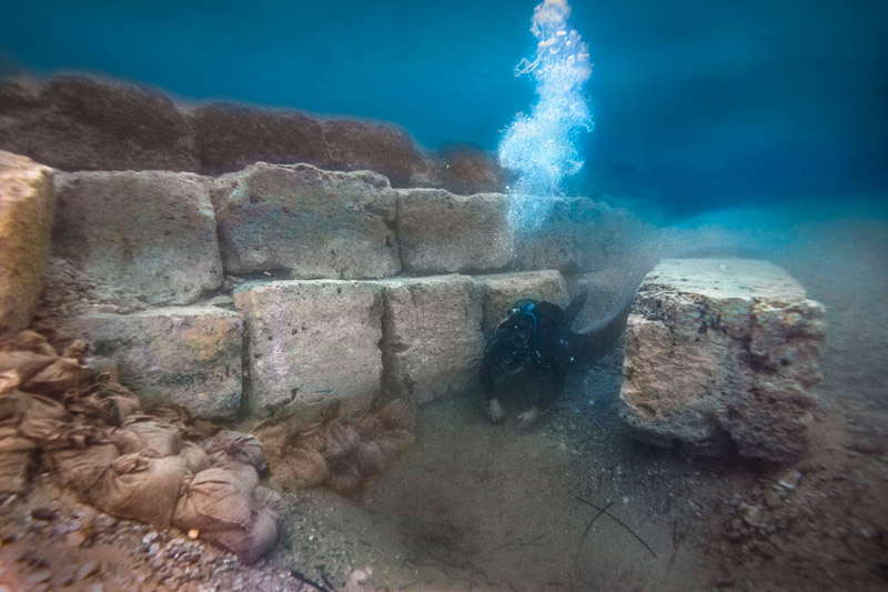
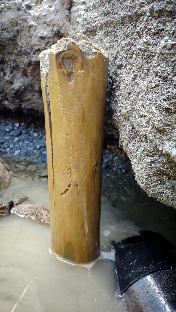
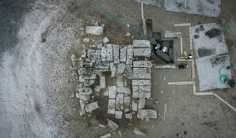
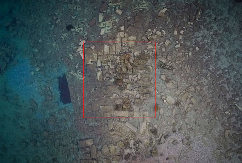
Researchers from the Greek Ministry of Culture and Sports and the University of Copenhagen are continuing to make important discoveries at Lechaion. Among them, structures that join the Inner and Outer Harbours, and a unique wooden bulwark that made up part of a mole flanking the entrance to the Inner Harbour.
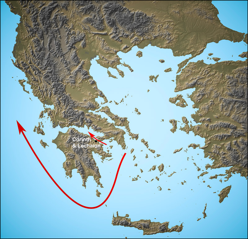
Lechaion, ancient Corinth’s main harbour town, continues to yield archaeological surprises. Located on the isthmus connecting the Peloponnese and the rest of mainland Greece, Corinth and Lechaion served as a perennial nexus of land and sea routes. From an early date Lechaion’s wharves swelled with trading goods, helping Corinth to become fabulously wealthy.
Ancient authors comment that transhipping goods at Lechaion was far preferable to sailing around the bottom of the Peloponnese, a kind of mini Cape Horn. One of them, the first-century BC author Strabo, quoted a timeworn proverb: “If you see Cape Malea [at the southeast tip of the Peloponnese], forget your home”
Throughout antiquity, Lechaion played a crucial role in supporting Corinth’s function as a cultural metropolis. Beginning in the 8th century BC her waterfront saw Corinthian colonists set out for Corfu and Sicily and elsewhere as they sowed the seeds of Hellenism to the rest of southern Europe. In addition, by the Late Roman period Lechaion, while still linked with Corinth, had developed her own identity as a town and religious centre. In the 6th century AD the town showcased one of the largest Christian churches of the time, the 180-m-long Leonidas Basilica.
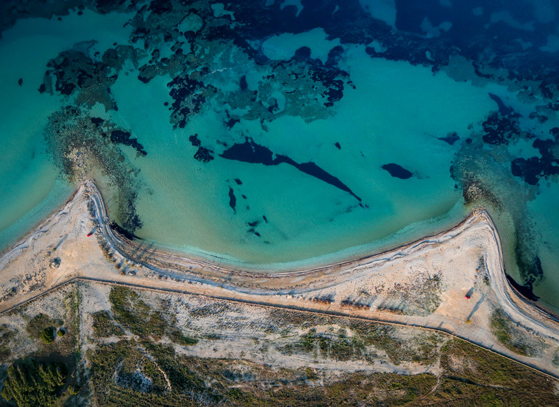
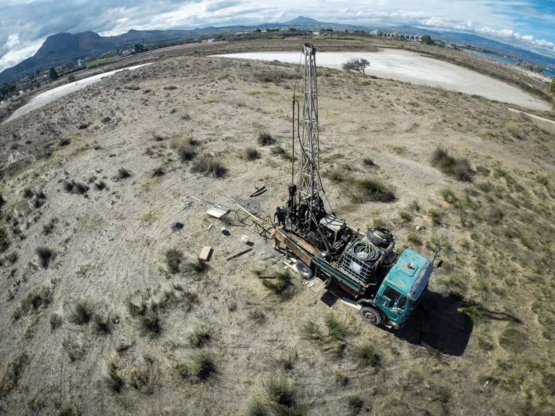
Greek and Danish archaeologists investigating Lechaion’s harbour areas are finding that the town appears to have been much more important than previously thought. In the course of three seasons they have delineated major offshore structures, a monumental entrance canal and several inland canals connecting at least four harbour basins. In total, the area is greater than 500.000 m2 – bringing it on par with other major harbour towns of the age, such as Athens’ harbours in the Piraeus and Roman Portus.
The archaeological site, however, has always been very difficult to grasp in its entirety. Most obvious to the first-time visitor are its massive mounds made up of spoil from ancient harbour dredging, thus creating a man-made barrier, as it were, between the town proper and the sea. Swampy, reed-lined canals snake between and behind the mounds and open into silty wetland harbour basins. Part of the archaeological problem is that the basins themselves, instead of being dredged according to a plan, are organically shaped because they were carved out of the several lagoons that made up an ancient river delta in this area. (see video above).
On the seaward side, off the wave-beaten beach, monumental architecture extends offshore as far as 80 metres, all submerged. What remains most puzzling to the archaeologists is the specific manner in which ships and shipping would have passed between the dynamic offshore zones and the zone of protected inner basins.
This year, however, topographical and geophysical surveys have successfully delineated the canal zone between the inner and outer harbours. In the process the team discovered that the entrance canal connecting the Inner and Outer Harbours was up to 30 m wide in the 4th and 3rd century BC, then grew narrower in later centuries. The precise reason why remains to be discovered.