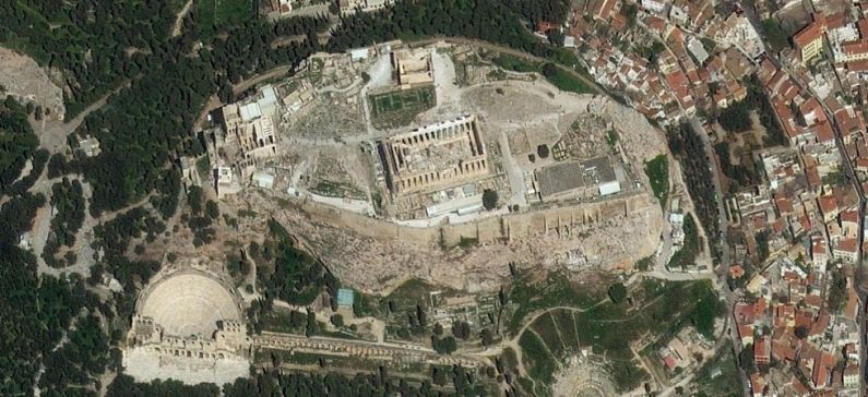
Satellites to uncover clues to Ancient Greece
Using satellite imaging, with a variety of sensor types and resolutions, modern day archaeologists can now map ancient cities and estimate the best locations for new digs. By combining information gathered via satellite — high-resolution photos in the visible and near infrared spectrum—with data analysis and manual surveys, archaeologists can more easily and safely uncover those lost civilizations.
James Newhard, director of archaeology and associate professor of classics at the College of Charleston is working on several projects involving a variety of technologies that are shining new light on the ancient world. The first involves designing a data system to study clay tablets depicting the oldest known form of Greek, from the Palace of Nestor in Pylos, Greece.
Another is the Avkat Project, a field survey in Turkey examining a historical trade route that linked Europe with the Far East. Here, satellite imaging allows experts to distinguish settlements, from the late Roman to the Ottoman eras, by linking smartphone GPS information to satellite images.
Additional analysis on the images is then performed in the lab–due to the computing resources necessary. Since raw data files from satellites are several gigabytes in size, the systems require the same kind of processing power necessary for computer games, 3D rendering or animation. “Ultimately, the same power as used for high-end gaming systems are a minimum requirement,” says Newhard.
Knowledge of specialized applications—such as ERMapper for image processing, the geographic information system ARCGIS, and ENVI, for geospatial and spectral data analysis—has become essential for image analysis and mapping, as well.
“You are either proficient in a range of software applications or you involve someone that is, as computer skills are necessary to analyze the data received,” says Newhard.
Newhard regards satellite imaging as a powerful tool that allows him to accelerate fieldwork, reducing the time taken for on-site surveys that would normally have taken years.
“Archaeologists are consummate borrowers and thieves,” says Newhard. “If there is something out there that will help me tease out more data, I’ll use it, as we are dealing with scraps and fragments of the past.”
Despite the gains technology offers archaeologists, sharing, comparing and merging data from different sources remains a challenge. One of the obstacles in handling data is that the volume involved is sometimes larger than what a desktop computer can handle comfortably, says Richard Tipper, Ph.D., executive chairman at Econometrica, a specialist in environmental data, mapping and management solutions.
Source: Forbes


